At cruising altitude, the view from an aircraft window can feel disorienting: endless clouds, oceans, or land with no visible markers. Yet flights stay precisely on course, reaching destinations on time. The reason lies in a layered navigation system that combines satellites, onboard instruments and ground-based support.
GPS: The primary guide
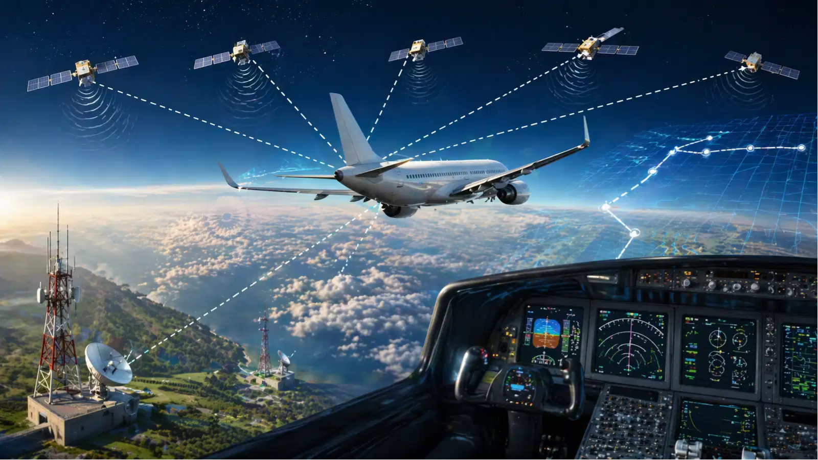
Modern aircraft rely heavily on Global Positioning System (GPS) technology. A network of satellites constantly sends signals to the aircraft, allowing its systems to calculate an exact position in three dimensions. At least four satellites are required to determine location and time accurately.
Also Read | World’s busiest airport 2025: THIS US hub beats Dubai for top spot
Inside the cockpit, pilots don’t just see a moving dot. Navigation displays show a detailed route made up of waypoints—fixed coordinates that guide the aircraft from departure to destination. The system continuously updates position, much like a highly advanced version of digital maps.
Inertial systems as backup
If GPS signals are disrupted, aircraft switch to Inertial Navigation Systems (INS). These systems track motion, speed, and direction from a known starting point using internal sensors. Because they don't depend on external signals, INS can keep the aircraft on track even during signal loss or interference.
Ground-based navigation aids
Traditional systems still play a role. Tools like Very High Frequency Omni-directional Range and Distance Measuring Equipment (DME) transmit radio signals from the ground. Pilots use these to determine direction and distance relative to fixed locations. This adds an extra layer of reliability.
Pre-planned routes and airways
Flights don't improvise their path. Before takeoff, pilots and dispatch teams prepare a detailed plan that includes waypoints, approved airways, cruising altitudes, and alternate airports. These airways function like highways in the sky, keeping traffic organised and predictable.
Air traffic control oversight
Even with advanced systems onboard, pilots are constantly supported by Air Traffic Control (ATC). Controllers monitor aircraft positions using radar and satellite tools, provide instructions, and ensure safe distances between flights. This coordination keeps the entire system running smoothly.
Also Read | Your plans to visit China might take a massive dip as ‘logistical nightmare’ disrupts travel
A system built on layers
Aviation navigation is designed so no single system is relied upon entirely. GPS offers accuracy, INS ensures continuity, ground aids provide reference, and ATC adds real-time oversight. Together, these layers allow aircraft to travel safely across vast, featureless spaces.
So while the sky may look empty, every flight is guided by multiple systems working in sync—ensuring pilots always know exactly where they are.