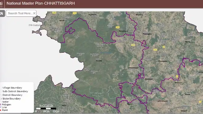
Chhattisgarh is increasingly using geospatial intelligence to improve governance, speed up planning and deliver public services more efficiently across urban and remote regions. Backed by the PM Gati Shakti National Master Plan, the state is integrating GIS-based tools and spatial data into decision-making across sectors ranging from infrastructure to healthcare.
Faster land identification for industry
One of the biggest changes has come in land allocation for industrial and infrastructure projects. Traditionally, identifying suitable land involved multiple departments and long approval timelines.
Also Read | Rain in Delhi today, but is a heat surge already on the way? IMD hints at what’s next
Through a Land Patch Analysis tool available on the Gati Shakti platform, government-owned land can now be filtered instantly based on size, ownership, proximity to transport networks and environmental constraints.
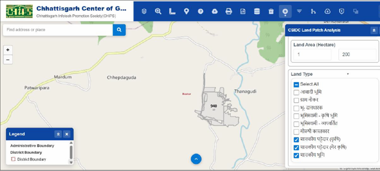 CSIDC land patch analysis tool and searching criteria.
 In one exercise around Raipur, planners identified 70 investment-ready land parcels within a 150-km radius using satellite-validated data and downloadable reports. The process that earlier took months can now be completed much faster.
Mapping financial inclusion in rural areas
The state is also using spatial gap analysis to improve banking access in rural regions. By combining data on bank branches, India Post Payments Bank centres, settlements and road networks, authorities can identify villages that remain outside the reach of formal banking services.
Also Read | No take-off without CM nod: Maharashtra ministers need Fadnavis approval for official flights
District-level coverage maps are then used to guide expansion plans and ensure government benefits reach underserved communities more effectively.
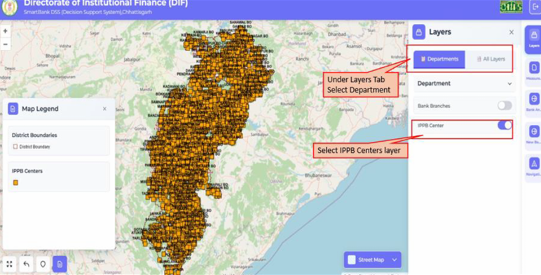 Selection process of departmental layers and Indian post payment bank.
 Improving access to Anganwadi centres
GIS tools are also helping improve access to Anganwadi services in tribal areas. In Kanker district, a 2-km buffer analysis helped identify habitations without Anganwadi coverage, allowing authorities to prioritise locations for new centres.
Spatial analysis has additionally been used to locate Anganwadi centres situated more than 500 metres away from the nearest road, helping planners align rural road expansion projects with public service delivery needs.
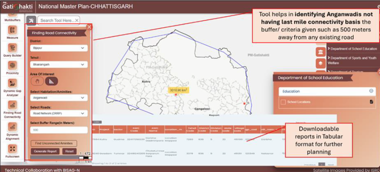 Identification of Anganwadis without last-mile road connectivity using finding road connectivity tool.
 Planning Sanjeevani marts and tribal connectivity
Chhattisgarh is also using GIS-based proximity and overlay analysis for the placement of Sanjeevani Marts, which provide affordable medicines while supporting tribal communities that sell forest produce. Site selection is based on factors such as settlement density, road access and tourism activity.
In remote regions such as Orchha tehsil in Narayanpur district, the platform is helping identify hamlets lacking road and healthcare access. Using a Dynamic Alignment Tool, planners can model the shortest possible road connections to nearby health centres.
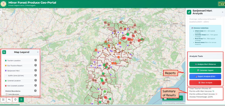 Tool tab provides a summary of mart distance analysis and report generation.
 According to the document, Chhattisgarh's model shows how spatial intelligence is becoming "a core instrument of governance" by enabling more precise and inclusive planning.