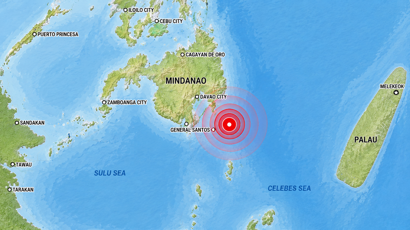
A magnitude-6.2 earthquake struck off the coast of Mindanao in the southern Philippines on Monday, just over a week after a far deadlier quake hit the same region.
The latest tremor was recorded by the United States Geological Survey at 5:18 pm local time (0918 GMT) at a depth of 112 kilometers, and no tsunami warning was issued. Authorities said there were no immediate reports of casualties or significant damage.
Also Read | Pakistan Air Force crash: Two pilots dead after training aircraft plunges near Mardan
🔔 M6.2 Earthquake detected near 67 km ESE of Pondaguitan, Philippines.
— Earthquake Alerts (@Earthquake2day) June 15, 2026
Magnitude: 6.2
Location: 67 km ESE of Pondaguitan, Philippines
Date: 2026-06-15 & Time: 09:18 UTC#earthquake #seismic #breaking #alert #Philippines pic.twitter.com/9Kx5VR2mYi
The aftershocks of a grim fortnight
The offshore quake added another layer of anxiety to a region still reeling from the June 8 disaster, which authorities said had killed at least 65 people and left at least 36 missing.
The earlier quake, measured at magnitude 7.8, had brought down buildings, triggered landslides, and displaced thousands across the southern Philippines.
It also injured more than 630 people; damaged over 3,100 homes; and disrupted transport and education, including the closure of General Santos International Airport and the suspension of classes in several provinces.
A cautious watch by the water's edge
Residents in parts of Mindanao described Monday’s earthquake as “strong but short,” while local reports said evacuation alarms were triggered in some buildings.
Kaiser Cadiz of the Davao Oriental provincial disaster office told AFP, “Our priority now is to monitor the coast to determine if there are indications the water has receded (a warning of an impending tsunami),” and added that no such signs had been observed.
The remark reflected the caution that still hangs over the coastline after the earlier quake had prompted tsunami warnings in parts of the region.
6.2-magnitude #Earthquake hits the #Philippines https://t.co/zRphv0EoyT #Forex #Markets #Finance #WallStreet #Trading #USD #NASDAQ #Economy #Inflation #StockMarket #NYSE #SP500 #Stocks #Economics #Bonds #GlobalMarkets #Currency #Traders #CurrencyTrading #FX #Geology
— Richard Krivo (@RKrivoFX) June 15, 2026
Nature's old habit returns once more
The Philippines sits on the Pacific Ring of Fire, one of the world’s most active seismic belts, where earthquakes are frequent and often destructive.
Mindanao has also been hit by other strong quakes in recent months, including magnitude 7.4 and 6.7 tremors in eastern Mindanao in October last year that killed at least eight people, underscoring the vulnerability of the southern island to repeated seismic events.
Also Read | US-Iran peace framework reached: Why the next 60 days could be important
FAQs
Q1: Where did the 6.2-magnitude earthquake strike in the Philippines?
Ans: The earthquake struck offshore near Mindanao in the southern Philippines on June 15.
Q2: Was there a tsunami warning after the 6.2-magnitude Philippines earthquake?
Ans: No, authorities and the USGS reported that no tsunami warning was issued following the quake.