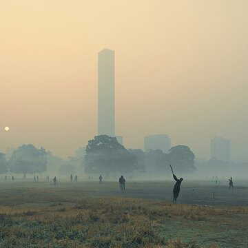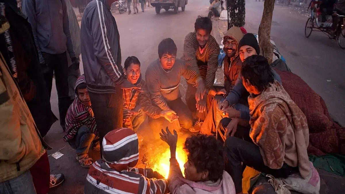
With utmost reluctance, residents of South Bengal, including Kolkata, somehow managed to leave their beds on Tuesday morning, pushing aside layers of blankets and quilts. They had to leave their beds by looking at the clock. There was no way to tell time due to the absence of sunlight. Bone-chilling cold winds were also blowing. It took several more hours for the fog cover to lift from vast areas of the southern part of the state. Around half past twelve in the afternoon, the sun god somehow managed to peek through and announce his presence. However, the wind speed did not decrease. Until then, there was no significant difference between Kolkata and 'Winterfell' from 'Game of Thrones'. It seemed as if Jon Snow or the frost-cold blue-eyed 'Night Walkers' would emerge from some fog-shrouded bend in the road. The city's minimum temperature had never dropped to this level since January 10, 2013 (9.6 degrees Celsius). However, more surprises were yet to come.
Also Read | Kolkata records coldest January day in 15 years as mercury drops to 10.2°C
A few hours later, when the weather office released the day's final bulletin, it was found that after the minimum temperature record, the day's maximum temperature had also made its mark in the record books. Kolkata's maximum temperature on Tuesday was 18 degrees Celsius. In the past three decades, the maximum temperature in Kolkata during January has been seen to drop below this level only five times. Just a day earlier, on Monday, the city's maximum temperature was 18.4 degrees. This temperature was the ninth lowest in the past three decades. Within 24 hours of that, there was another record-breaking drop in the day's temperature.
Why the cold has intensified across Bengal?
The Meteorological Department had forecast around September. It had announced that India was going to experience 'severe' winter this time due to the influence of 'La Nina' conditions. When the surface temperature of the Pacific Ocean remains below normal, meteorologists refer to it as a 'La Nina' situation. When such conditions develop, the Indian subcontinent receives more rainfall than normal and the average winter temperature remains below normal. The Meteorological Department had made such a winter forecast as a result of the 'La Nina' conditions developing in mid-2025. However, the beginning of winter was not at all 'promising' for Bengal. November passed in considerable heat. The first three weeks of December also disappointed winter enthusiasts.
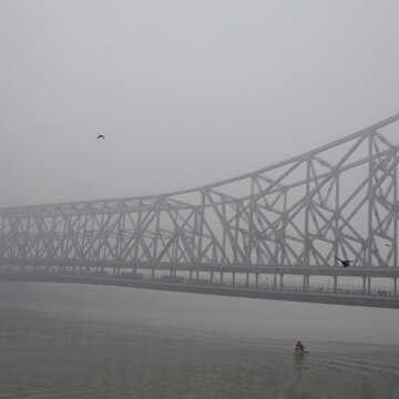
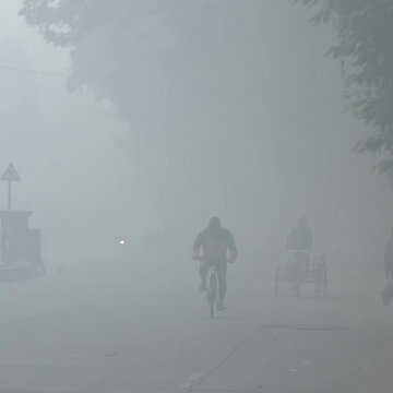
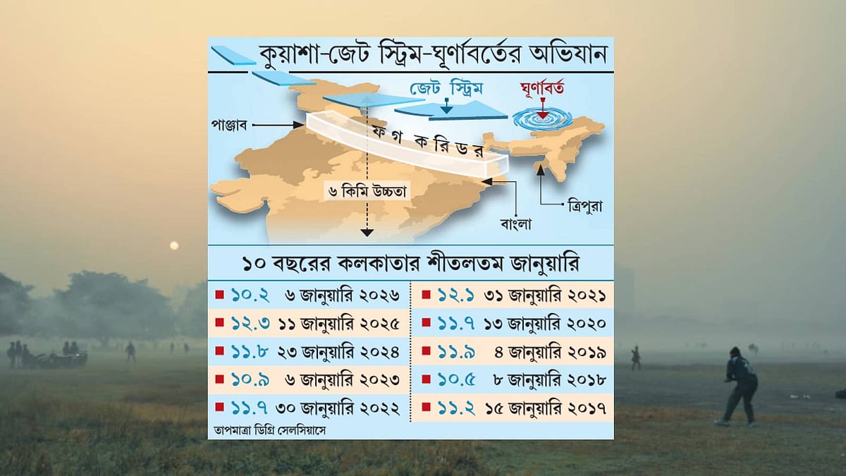
The situation began to change from Christmas morning. For the next 12 days, the bone-chilling cold 'northerly' winds not only froze the bones of the northern states of the country but also the entire Bengal. Along with the regular temperature drop, a thick fog cover extending from Punjab, Haryana, Uttar Pradesh, Bihar, Jharkhand to Bengal provided worthy accompaniment. Wherever this 'fog corridor' has formed, the sun is not visible until well into the day in all those places. Not for one or two days — this situation has been continuing for more than a week straight. Therefore, there is no opportunity to enjoy the pleasure of basking in the sun on winter mornings.
Meteorologists from the Indian Institute of Tropical Meteorology (IITM) in Pune report that such conditions have developed in the country due to multiple simultaneous weather events. The 'La Nina' conditions had already been established earlier. On top of this, the sudden departure of storms formed in the country's northwestern region made the entry of northern cold winds completely unobstructed. The combined effect of that cold wind flow and the 'fog corridor' was sufficient to bring down both day and night temperatures. Additionally, a cyclone has also formed over Tripura. This cyclone is pulling the strong cold wind current or 'jet stream' flowing through the uppermost layers of the atmosphere down to places much closer to the ground towards itself. As a result, from Chandigarh in cold-stricken northwest India to Krishnanagar in South Bengal, everything is numb with cold.
Also Read | Minimum temperature hovers near 10°C, biting cold to stay in Kolkata for several more days
Regarding how long such conditions will continue, meteorologists say, 'Today Wednesday and Thursday, 'cold day' and 'cold wave' conditions will persist simultaneously in some areas of Birbhum and East Burdwan. Besides this, 'cold day' conditions will develop in Hooghly, Murshidabad, Nadia, West Burdwan and North and South 24 Parganas.' If the minimum temperature of any place drops below 10 degrees Celsius and simultaneously that minimum temperature remains at least 4.5 degrees below normal, it is called a 'cold wave'. On the other hand, if the maximum temperature remains below 10 degrees Celsius and simultaneously the day's temperature drops at least 4.5 degrees Celsius below normal, it is called a 'cold day'. It is believed that the intensity of winter in the state may decrease somewhat from the end of this week.