The people of Delhi and the adjoining National Capital Region (NCR) woke up to a thick blanket of fog on Tuesday morning, leading to reduced visibility in several areas.
Yellow alert issued
The India Meteorological Department (IMD) had to issue a yellow alert for dense fog as the national capital recorded its coldest February day in the past four years on February 2. Fog or mist is expected in Noida during the early morning hours.
The weatherman has predicted that both maximum and minimum temperatures for Noida could remain at around 21 degrees and 11 degree Celsius respectively. Very little to no cloudiness has been forecast for Gurugram during this same period where the maximum temperatures for could likely remain below 22 degrees and minimum temperatures could go as low as 9 degree Celsius or even lower.
On Tuesday, st the Safdarjung weather station, the temperature was recorded at 17.5 degree Celsius, which is 4.8 degrees below normal. Meanwhile, other areas of North India have also been affected by dense fog, including Punjab, Rajasthan, Uttar Pradesh and Haryana. Additionally, more rain is expected across parts of Madhya Pradesh, eastern Rajasthan and Uttar Pradesh.
Gradual fall in temp likely
As the weather across India is expected to change, the National Capital Region (NCR) including Delhi, will witness decreases in temperature steady over the next week. Foggy conditions are expected in the morning due to atmospheric effects over North India having an effect on this area.
The IMD reported that weather patterns associated with both western disturbances and the circulation of storms will have the largest impact on local weather after February 2. Minimal temperatures will likely decline by between 2 and 4 degrees.
Maximum temperatures, which are comfortable now, are expected to drop below normal in two days. This change suggests that cooler daytime conditions will move into the capital and nearby areas.
Will it rain in Delhi?
The weatherman has indicated that there will be clouds throughout the day. With both rain and cloudy skies, cold weather is likely to dip the early morning temperatures for residents.
No rainfall has been predicted for February 3 in Delhi. Forecasted high temperatures are expected to be around 19 to 21 degrees while minimum temperatures are expected to remain around 7 to 9 degree Celsius. With the increased levels of humidity in the air coupled with limited sunshine, the overall feel will continue to drop throughout the day and into the evening hours.
Also Read | No slab cuts for salaried class, no standard deduction: Here's why Budget left middle class disappointed
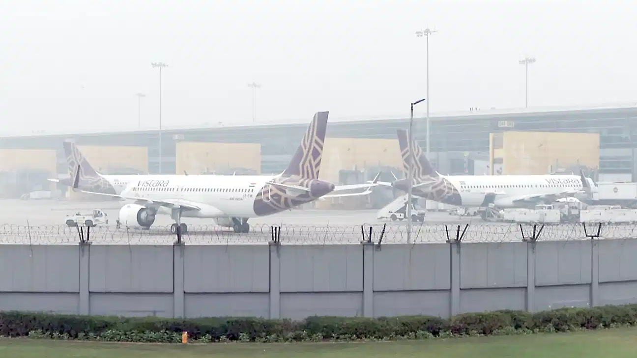
Flight ops likely to be hit
Moreover, the weather department has warned of strong surface winds, with speeds between 55 and 60 kilometre per hour. Winds are expected to come from the northwest, which could cause temperatures to feel lower than the actual readings.
Dense fog is likely in the morning, significantly reducing visibility in parts of the city. This could affect road traffic and flight operations, especially during the early hours. The current western disturbance has already caused rainfall in several areas of North India.