An interactive tool has been unveiled by NASA, which enables people to generate names with the help of satellite images of Earth, making the years of research findings personal for users.
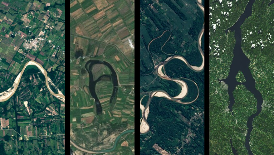
"Your Name in Landsat" is a novel project by NASA that uses imagery obtained through the Landsat mission to convert land features on Earth into letter shapes. The rivers take the shape of "S", deserts become round and linear, and cities give rise to geometrical designs along the coastline.
This innovative project was launched at the time of Earth Day 2026.
From satellite data to personal expression
All imagery utilised in the program has come from NASA’s Landsat program, which was implemented by the space agency along with the United States Geological Survey, and has been providing ongoing observations of Earth since 1972.
Also Read | From ravioli to royal honey: Inside King Charles’ lavish White House feast
The latest satellite in the series, Landsat 9, scans the whole globe every 16 days and provides an extensive collection of images. Images from all over the world, everything from glaciers to forests to grids of cities are being turned into works of art.
According to NASA, the aim behind the new project is to create an experience of relatability with the Earth imagery so that people can explore them beyond just for scientific purposes.
Why landscapes resemble letters
The letter formations are not digitally altered but emerge naturally from patterns on Earth’s surface.
The meandering river system creates curved shapes, the volcano forms a crater which looks like a circle, while the irrigation fields form geometrical figures. Urban roads and structures, on the other hand, have straight lines and sharp angles similar to alphabets like A, X or N.
Using Landsat images taken at 30 meters’ resolution, users are able to identify such patterns above ground making the earth look like a giant drawing board.
The planet can spell your name – literally. 🔤🌍
— NASA's Kennedy Space Center (@NASAKennedy) April 22, 2026
This Earth Day, see your name written in landscapes captured by Landsat: https://t.co/kcP12dhsI2 pic.twitter.com/z2Ubn42iY1
How users can create their own names
By choosing satellite images that form individual letters. According to NASA, a number of sites should be visited for this purpose including Earth Observatory and USGS Earth Explorer.
The process involves identifying shapes, cropping and rotating images, and assembling them using design tools. Since Landsat data is publicly available, users can download and reuse the images freely.
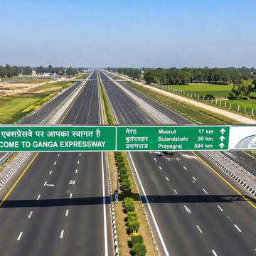
Also Read | Rs 36,230 crore, 12 districts, one mega corridor — Ganga Expressway explained
A digital trend with a scientific edge
The tool is trending online, particularly among younger audiences, who are sharing personalised name designs across social media.
Beyond its visual appeal, the project subtly highlights environmental patterns and Earth’s changing landscapes, blending creativity with scientific awareness.
By turning satellite imagery into something interactive and shareable, NASA appears to have found a new way to bring complex data closer to everyday users.