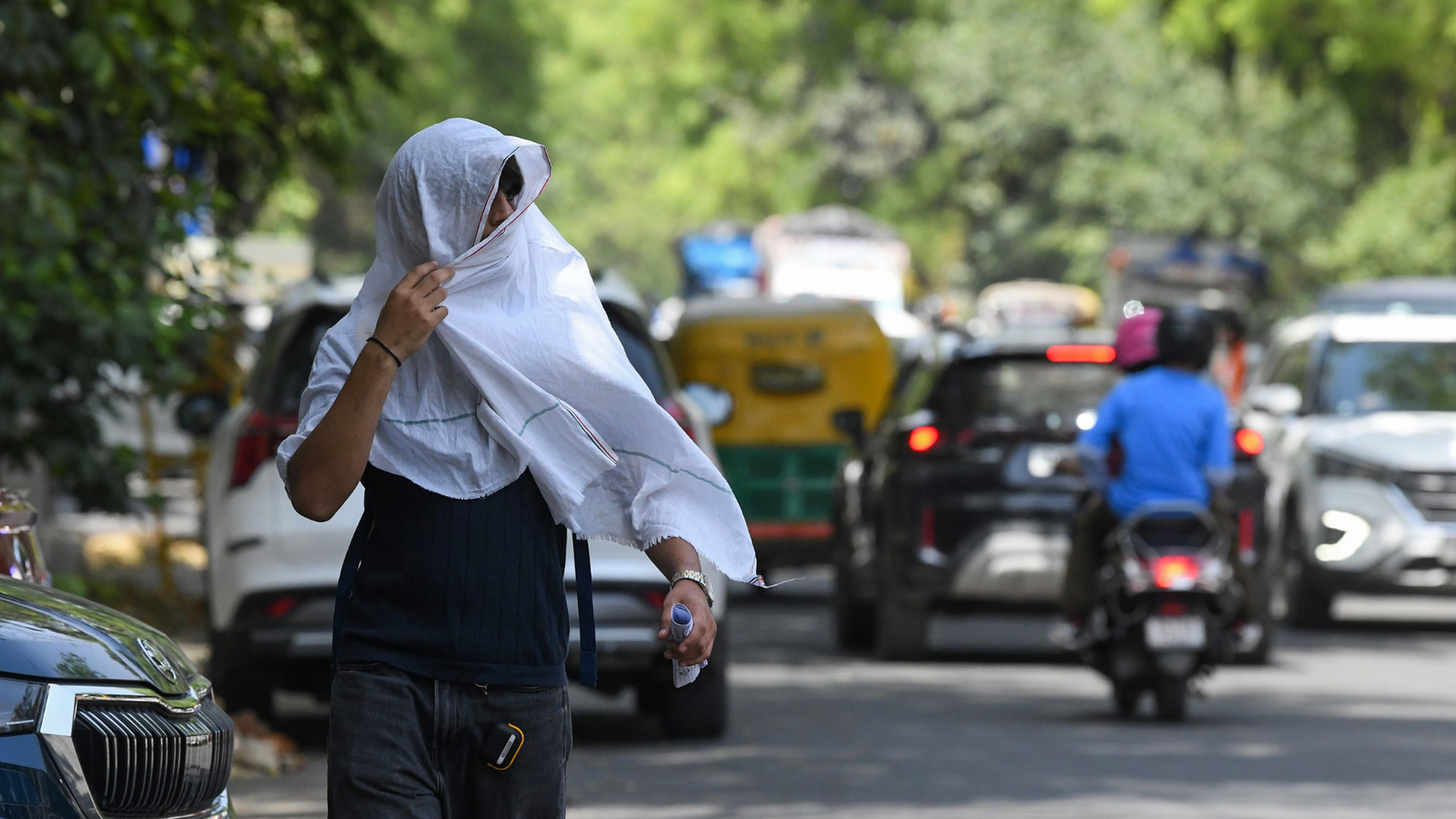
Delhi witnessed its first citywide heatwave of the season on Saturday, with the base observatory at Safdarjung recording a maximum temperature of 42.8C, which is 5.1 degrees above normal. This marks the highest April temperature at the station in the past four years. For comparison, Safdarjung had touched 43.5C in late April 2022.
According to the India Meteorological Department (IMD), a heatwave is declared when temperatures cross 40C and remain at least 4.5 degrees above normal, or reach 45C regardless of deviation. For a citywide declaration in Delhi, at least two stations must meet these conditions, including Safdarjung. On Saturday, four out of five key monitoring stations crossed the threshold, confirming the widespread heatwave.
Multiple stations breach heatwave criteria
The Ridge station recorded the highest temperature in the city at 44.5C, which is 6.1 degrees above normal. Lodhi Road reported 42.6C, Ayanagar 43.2C, and Palam 42.5C, all reflecting significant departures from seasonal averages.
Also Read | What’s behind Delhi hitting 43C before May even begins?
Minimum temperatures also stayed above normal, adding to the discomfort. Safdarjung recorded a minimum of 25.2C, while Palam registered 26.8C. No rainfall was observed in the 24 hours ending 5:30 pm on Saturday, allowing heat to build up further.
IMD issues yellow alert, conditions to persist briefly
The IMD has issued a yellow alert for Sunday, cautioning residents about continued heatwave conditions. Officials confirmed that such conditions have persisted for three consecutive days across the region. “Heat wave conditions have been realised at many places over Delhi. This is the third consecutive day of heat wave realisation over the Delhi region. These conditions are likely to continue till Sunday. Under the influence of the setting in of lower tropospheric level easterly winds, maximum temperatures are likely to fall, leading to abatement of heat wave conditions over the region from April 28,” an IMD official said.
The current weather pattern is driven by dry northwesterly winds and intense solar heating, both common factors during early summer in northwest India.
Rain, thunderstorms may bring slight relief
Weather experts indicate a possible shift from April 27 onwards. “No relief is likely until chances of some rainfall across northwest India from April 26 to 28. There could be a slight cooling effect. This is likely because of a cyclonic circulation developing over Rajasthan, with chances of rain over Punjab, Haryana and Delhi, among other places in northwest India,” said Mahesh Palawat, vice chairman at Skymet Weather.
Also Read | What is the ‘sun tax’? Here’s why your wallet feels the heat before you do this summer
The IMD has also pointed to a change in wind patterns, with easterly winds expected to bring some moisture. This could lead to isolated thunderstorms, light rain, and gusty winds between April 27 and 29. Daytime temperatures may drop by 2 to 4 degrees Celsius during this period, depending on cloud cover and rainfall.
Air quality dips as heat intensifies
Delhi’s air quality worsened alongside rising temperatures. The air quality index stood at 243 on Saturday, compared to 226 on Friday, both falling in the “poor” category. The Central Pollution Control Board has indicated that air quality is likely to remain in the same range through Sunday.
While brief relief is expected early next week, temperatures are projected to stay above normal even after heatwave conditions ease.