A set of detailed satellite images showing US military deployments across the Middle East began circulating online days before the Iran war started, raising questions about how openly available geospatial intelligence can track global military movements.
The images were reportedly shared by MizarVision, a Chinese artificial intelligence startup with fewer than 200 employees based in Hangzhou and Shanghai. The pictures showed aircraft parked on runways, transport planes arriving at desert airfields and aircraft carriers positioned in the Mediterranean. What made the images unusual was that the labels and annotations were written in Mandarin rather than English.
The images identified aircraft types, missile defence systems and troop concentrations with precise geolocation. Some photos showed Lockheed Martin F-22 stealth fighters parked on the ramp at Israel's Ovda Air Base, while others captured aircraft buildup at Prince Sultan Air Base in Saudi Arabia. Additional images mapped US military bases across Qatar, Jordan and Bahrain.
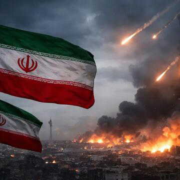
Just days later, on February 28, the United States and Israel launched Operation Epic Fury, a joint air campaign targeting Iran. Tehran responded with missile and drone attacks soon after.
Satellite images tracked military deployments
The first batch of satellite imagery reportedly appeared on February 20, showing US aircraft transfers to Ovda Air Base in southern Israel and deployments across several Middle East locations, including Saudi Arabia and Qatar.
Each image was analysed using artificial intelligence tools. Aircraft were labelled by type, support systems were identified and missile defence installations were highlighted.
By March 1, the dataset had expanded further. New images mapped military bases in Jordan, Kuwait, Bahrain and the United Arab Emirates. The imagery also documented naval movements in the Arabian Sea.
Among the assets identified were several high-value US platforms. Satellite images showed seven F-22 stealth fighters parked on the tarmac at Ovda Air Base, while four more were spotted on the runway shortly before combat operations began.
Aircraft carriers and naval activity are monitored
Naval deployments were also tracked from orbit. MizarVision released satellite photos of the USS Gerald R Ford, the newest aircraft carrier in the US Navy, after it departed Souda Bay naval base in Crete. The carrier’s deck showed Boeing F/A-18E/F Super Hornet fighters and Northrop Grumman E-2D airborne early warning aircraft.
Another image captured the USS Abraham Lincoln carrier appearing to rendezvous with a resupply vessel in the Arabian Sea near Oman.
The company also combined satellite imagery with open-source flight tracking data. Analysts tracked a US Navy Boeing P-8A maritime patrol aircraft departing Isa Air Base in Bahrain and flying toward the region where the Lincoln carrier group was believed to be operating.
ALSO READ | Solo traveller’s viral video raises questions over scuba training conduct in Hurghada | WATCH
Satellites captured images of the USS Ford aircraft carrier operating in the Red Sea, and its carrier-based transport aircraft also arrived at the Ovda Air Base in Israel. pic.twitter.com/ZqOcg5Tp8O
— MizarVision (@MizarVision) March 8, 2026
Unlike Western satellite companies such as Maxar Intelligence or Planet Labs that operate their own satellites, MizarVision mainly works as an analysis and data-processing platform. The firm combines publicly available datasets such as commercial satellite imagery, aircraft tracking signals and ship tracking data.
These datasets are processed using artificial intelligence models that automatically identify military equipment, producing geospatial intelligence similar to what national intelligence agencies traditionally generate.
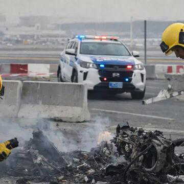
There is no confirmed evidence that Iran used the imagery to guide its attacks. However, several locations highlighted in MizarVision’s posts were later targeted during Iranian missile and drone strikes
One of those sites was Al-Udeid Air Base in Qatar. Iran also targeted facilities in Jordan, including Muwaffaq Salti Air Base, where a $300 million AN/TPY-2 radar system used by US THAAD missile defence units was destroyed. Satellite images later confirmed the loss of the radar installation, which had been critical for coordinating missile defence across the Gulf region.