An unusual weather system has been sweeping through various parts of India, Pakistan, and Afghanistan, causing widespread rain, thunderstorms, gusty winds, and even hailstorms during a time of the season when summer conditions normally start setting in. What makes this unusual weather system special is not only its timing but also its unusual formation, which is rarely seen in the region, stretching as long as 1,000 km.
This unusual weather system has been caused by a western disturbance, but what has made it unusual is its formation as a long trough stretching from Afghanistan through Pakistan and then India. In normal circumstances, western disturbances take their usual formation as an extratropical cyclone over the Mediterranean region and then move in a curved shape towards the Himalayas during the winter season.
However, in this case, it has assumed the formation of a straight rain band. An upper air cyclonic circulation has been building up over the northern parts of Pakistan, causing thunderstorms, winds of 40-80 kmph, and even hailstorms in various parts of the region.
Also Read | Delhi records wettest March in years as unusual weather grips capital, IMD explains why
Widespread impact across regions
The system has already caused heavy to very heavy rainfall in the sub-Himalayan West Bengal and Sikkim region. The southern states of Karnataka, Andhra Pradesh, Kerala, and Tamil Nadu have also received rainfall. Hailstorms have been observed in various places.
The disturbance is currently interacting with a number of cyclonic circulations over north Madhya Pradesh, east Uttar Pradesh, west Rajasthan, Haryana, northeast Assam, and southern India.
Moisture feeds the system
The moisture source for this system is provided by various water bodies such as the Mediterranean, Caspian, Black Sea, and Persian Gulf. As it moves towards the east, it picks up moisture from the Arabian Sea. This is further supplemented when it crosses the Himalayas, causing rain.
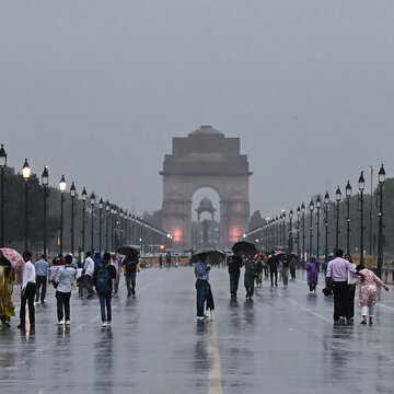
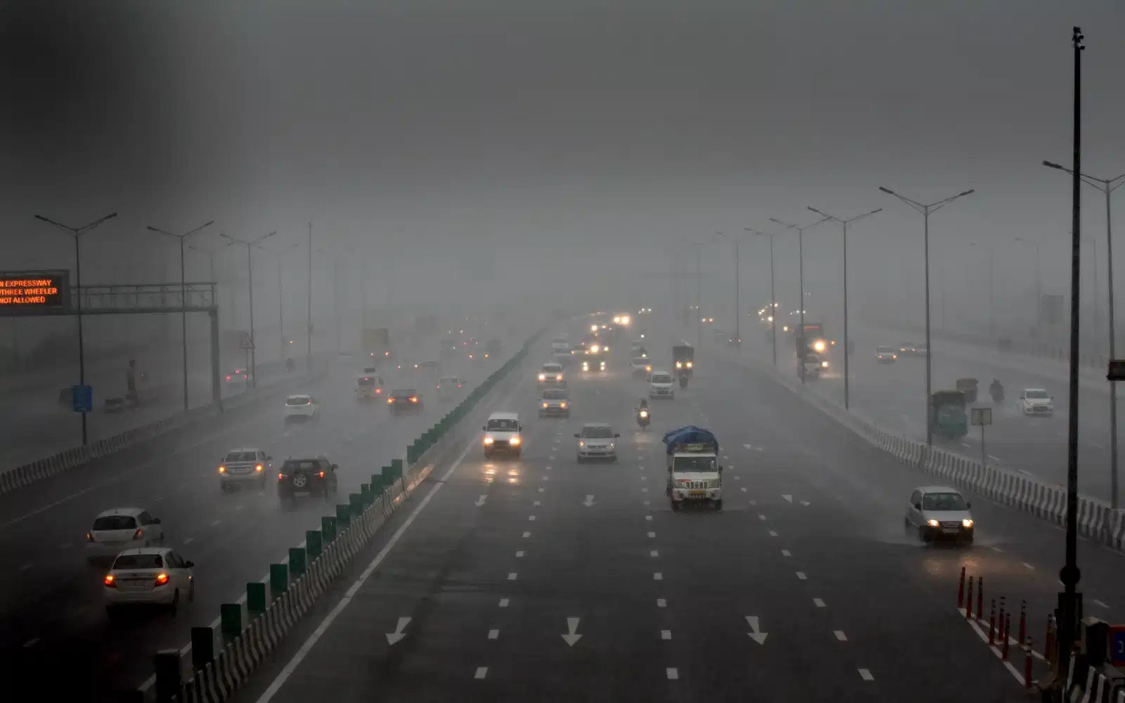
Delhi-NCR forecast
For the areas around Delhi and the National Capital Region, light to moderate rain, thunderstorms, and winds of 30-50 km/h can be expected until Friday. Day temperatures will be in the range of 25-28 degrees Celsius, significantly lower than the normal for this period.
Also Read | 'High-risk' environment flagged—India restricts flights across 11 regions
The prevailing western disturbance is expected to remain active over the Western Himalayas and plains up to Friday, after which activity may decrease. A weaker disturbance is, however, expected to approach the region around March 22.
Why is this unusual for March?
Western disturbances are most active from December to February, after which there is a marked decrease in activity by the end of March. Such systems of this scale are rare in the region during this time. Trends, however, suggest a shift in the activity of such systems, which are now lasting longer in the spring.